
Humpback Rocks
At the northern end of the Blue Ridge Parkway in Virginia is Humpback Rocks. Humpback Rocks stands out from many other mountain summits in the Blue Ridge due to its exposed rocky summit, in contrast to the heavily vegetated peaks of surrounding mountains. Humpback Rocks is located between milepost 5 and 9.3 just outside the town of Waynesboro, VA in Augusta and Nelson counties. The rock is so named for the visual effect of a “hump” it creates on the western face of the mountain at an elevation of 3,080 feet. The prominent rock outcrop was a landmark guiding wagon trains over the Howardsville Turnpike in the 1840s.
The early European settlers of the Appalachian Mountains forged a living from the native materials so abundant around them. Hickory, chestnut and oak trees provided nuts for food, logs for building and tannin for curing hides, while the rocks were put to use as foundations and chimneys for the houses and in stone fences to control wandering livestock. Many self-sufficient farms sprang up in the Humpback Mountain area.
Visitor Center
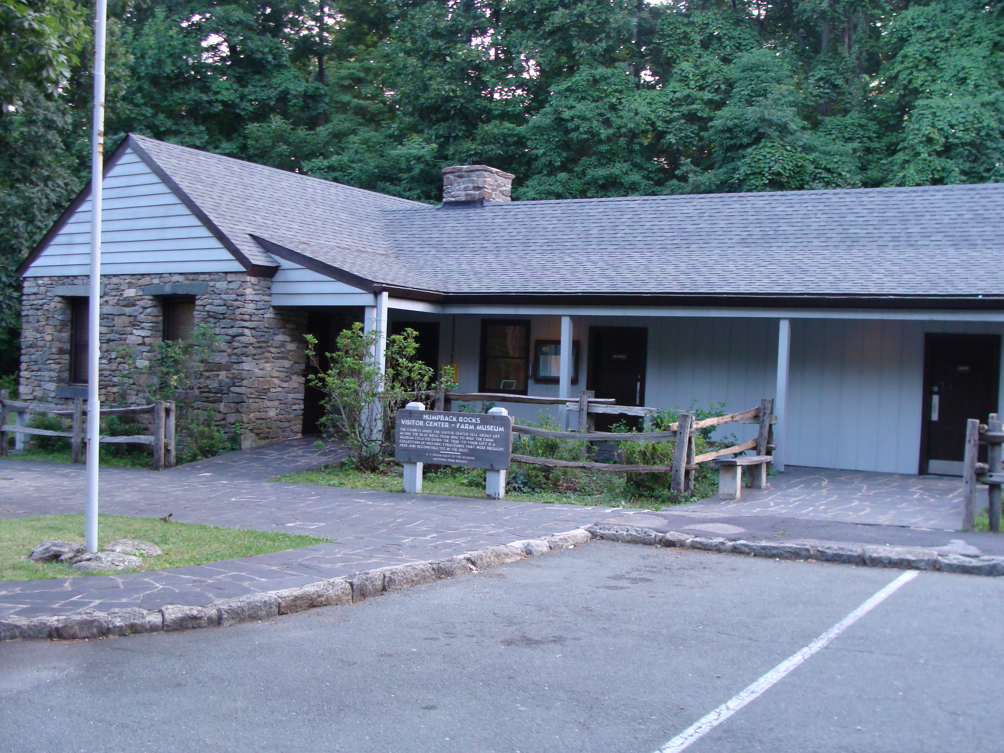
The visitor center and mountain farm exhibit include a single-room log cabin and a few outbuildings that represent elements of regional architecture of the late 19th century. Early Parkway designers collected buildings from nearby and assembled them here in an arrangement that allows for an easy stroll along the pathway. Costume interpreters provide demonstrations of weaving, basket making and gardening. There is also a picnic area and comfort station which all is wheelchair accessible.
Humpback Rocks Visitor Center phone: (540) 943-4716
Hiking Trails
- Mountain Farm Trail (easy .25 mi.)
- Appalachian Trail (strenuous 2 mi.)
- Catoctin Loop Trail (moderate .3 mi.)
- Greenstone Trail (moderate .2 mi.)
Directions
Hiking Humpback Rocks
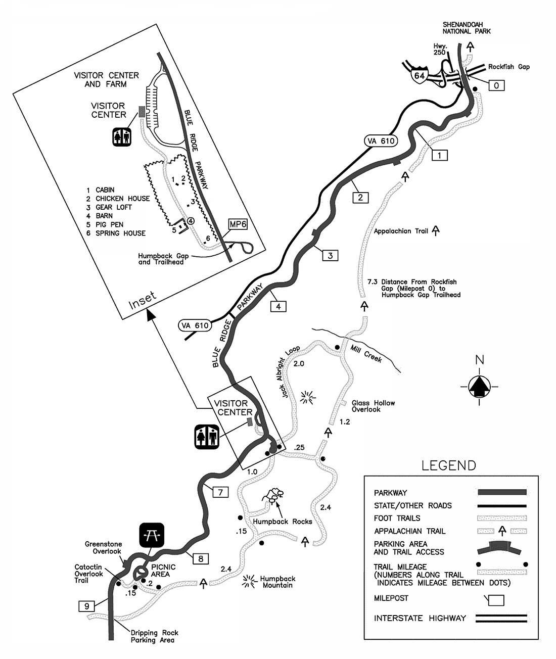
Hiking Humpback Rocks is a relatively short hike following a 2.0-mile (3.2 km) trail loop. With a roughly 45-minute hike to ascend 740 feet (230 m) to the peak, and a 20-25-minute descent, this ranks as one of the shorter hikes along the Blue Ridge, however it remains one of the most rewarding. The peak affords a spectacular 360-degree view of the surrounding terrain. To the north you can see into the southern section of Shenandoah National Park, to the east check out the patchwork of farms, to the southwest you see thick woods and mountain ridges of the George Washington National Forest.
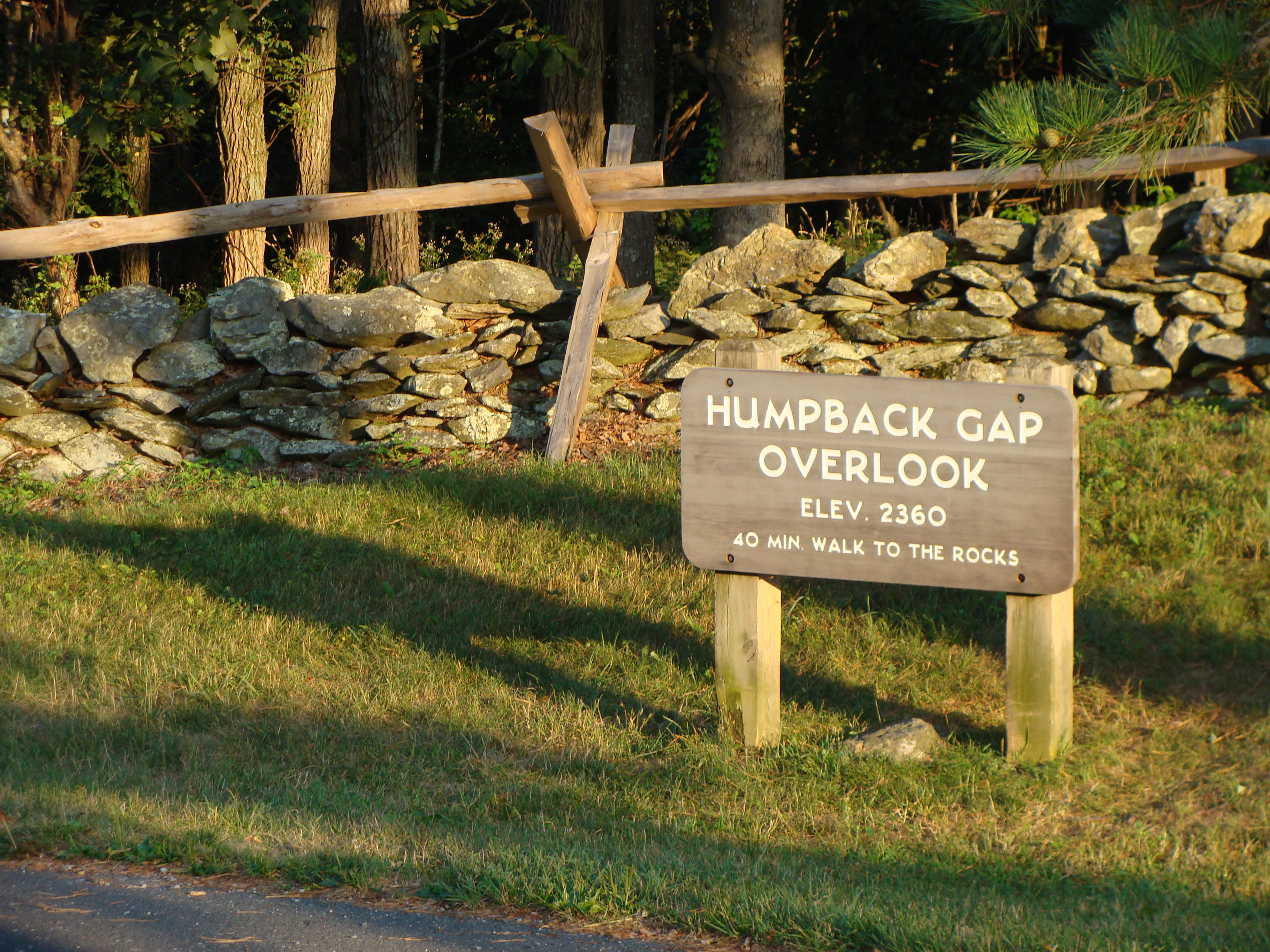
Hikers may continue to follow the Trail for .5 miles (0.80 km), passing along the top of a cliff with views to the south and east before descending 1.2 miles (1.9 km) to a blue blaze trail. This trail leads .3 miles (0.48 km) into the Humpback Rocks Picnic Area. The distance between Humpback Gap and the Humpback Rocks Picnic Area is 3.6 miles (5.8 km). A map of the hike and of the Humpback Gap Overlook is available through the Blue Ridge Parkway website.
Continuing past Humpback Rocks itself, the summit of Humpback Mountain is only a few minutes further. The Appalachian Trail is only a short hike to the north, at milepost 6.
Directions
The Humpback Rocks Visitors Center is located at milemarker 5.8, six miles south of the Rockfish Gap Interchange of I-64 and US 250. It is most easily accessed by either one of these two highways. Head south on the Blue Ridge Parkway for 5.8 miles (9.3 km) to reach the Humpback Rocks Visitors Center, or continue another 0.2 miles (0.32 km) to arrive at the Humpback Gap parking area on the left.
Appalachian Trail
The Appalachian Trail can also be accessed from the Humpback Gap parking area. Southbound hikers can reach it by continuing south on the Humpback Rocks trail. Northbound hikers can reach it taking the one mile (1.6 km) blue blazed path at the northern end of the parking lot, or the one mile (1.6 km) white blazed path just off of the Howardsville Turnpike.